Camino de los Dioses

Camino de los Dioses
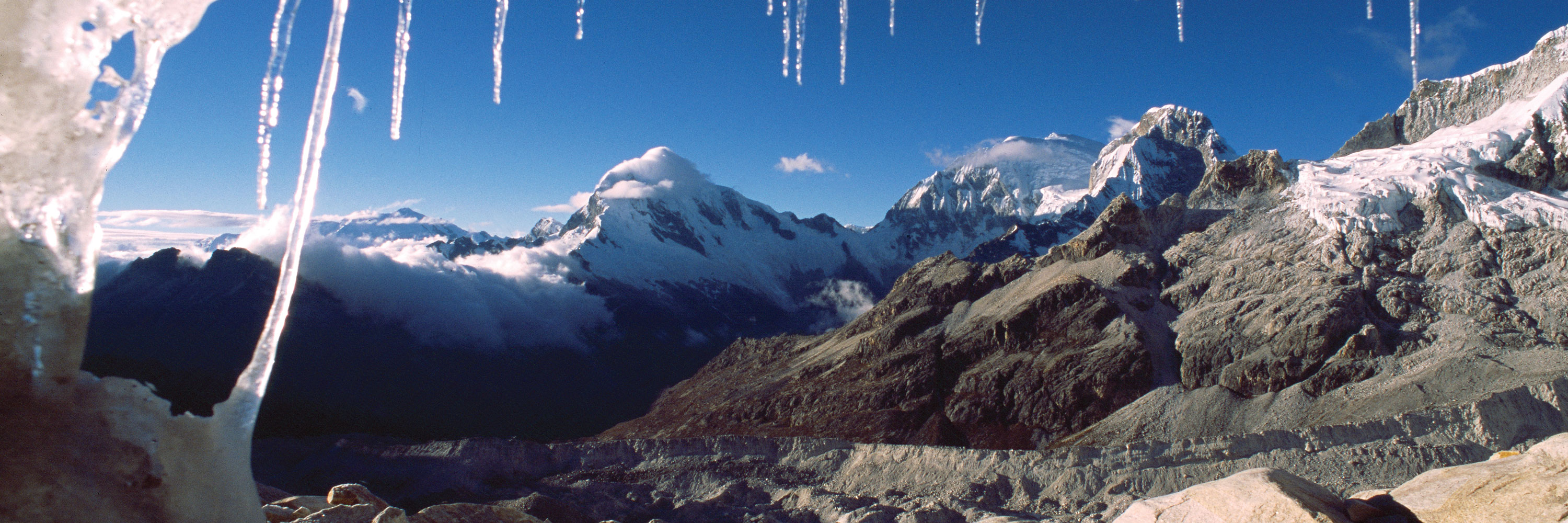
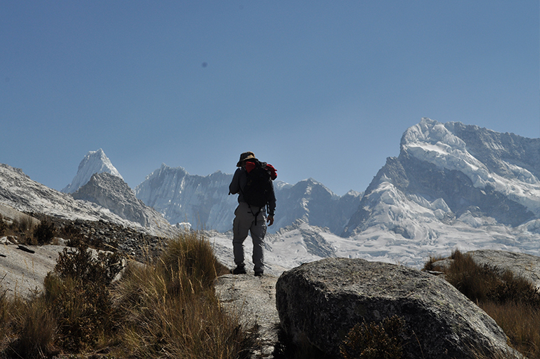
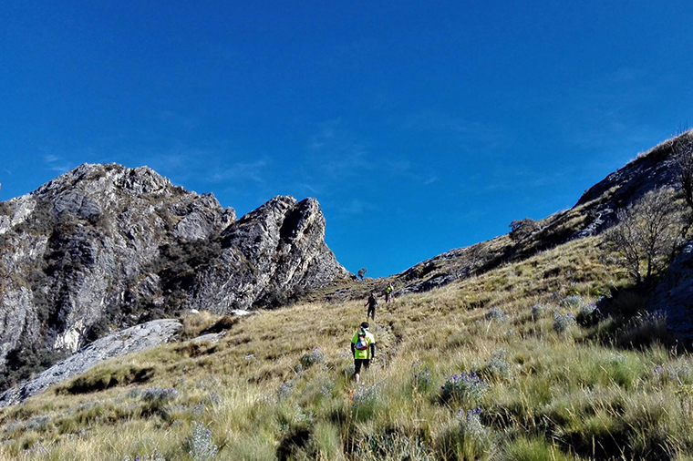
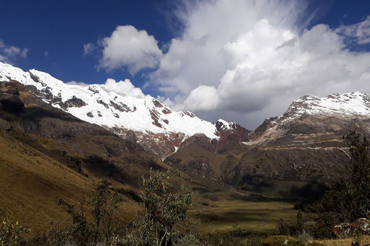
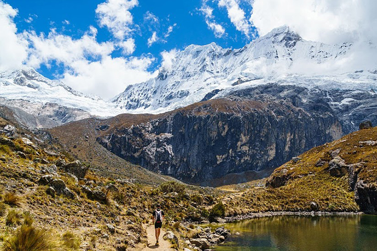
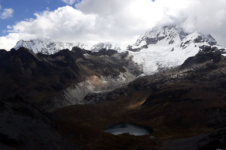
We are proposing a new trail of 11 days, that can take you to an elevation of 5100 masl. (one of the highest trail in the world!) The best way to live the Andes experience and enjoy outstanding and wild landscapes. Please contact DB600 for more information regarding this unique treck www.donboscoexpedition.com
Hike Facts
Difficulty: EE a tratti F+
Duration: 11 days
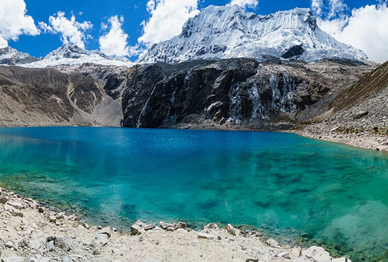
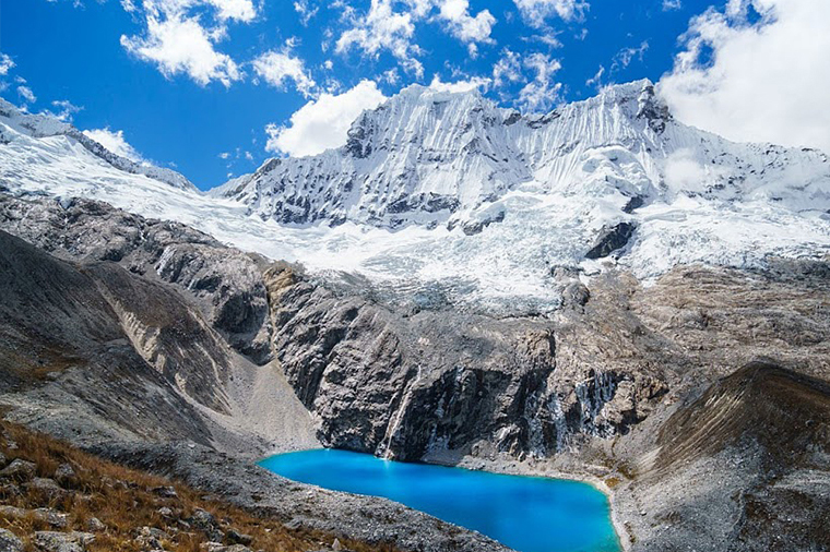
Where: Huaraz, Shilla, Yanama.
Highest elevation reach: 5100 masl
When to go: May to September
Starting / Finishing point: Bosque de Huaypan - Tiendayoc
Requested documents: Huascaran National Park Ticket
Challenge: Moderate - difficult
Trail description
1 – BOSQUE DE HUAYPAN 3500 M – REFUGIO HUASCARÁN (4600 M)
Elevation gain: 1150 m approx
Elevation loss: 50 m approx
Approximate hiking: 4-5 hours.
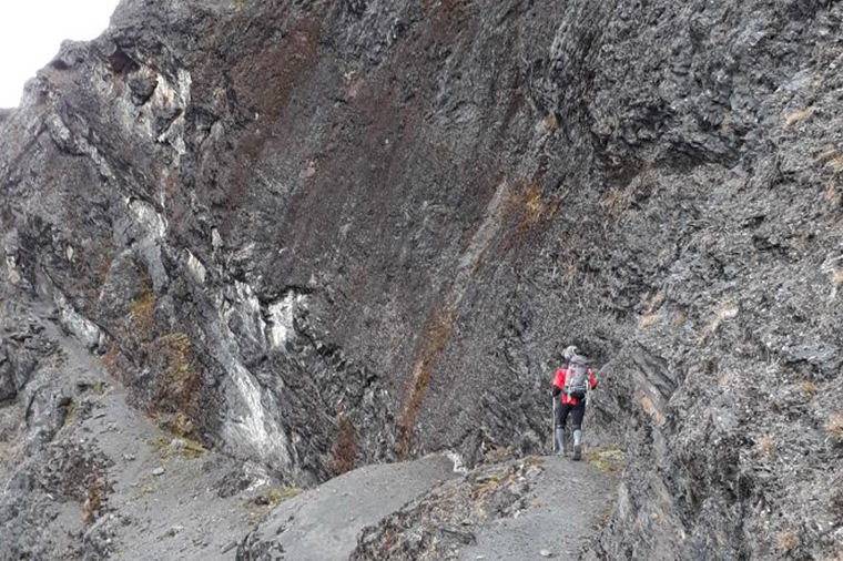
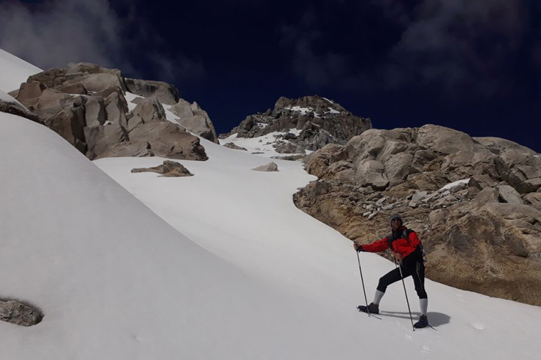
Difficulty: EE, robes are needed on certain point.
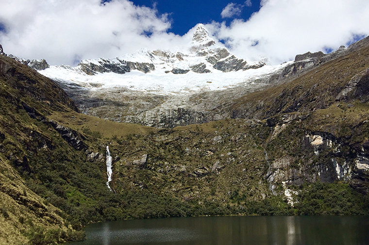
2 - REFUGIO HUASCARÁN 4600 M – LAGUNAS DE LLANGANUCO (3850 M)
Elevation gain: 300 m approx.
Elevation loss: 1450 m approx.
Approximate hiking: 6 hours.
Difficulty: EE.
3 – YURAC CORRAL 3850 M – REFUGIO PERÙ AL PISCO (4665 M)
Dislivello: 820 m.
Approximate hiking: 4-5 hours.
Difficulty: E
4 – REFUGIO PERÙ 4665 M – LAGUNAS BROGGI (4570 M)
Elevation gain: 460 m approx.
Elevation loss: 560 m approx.
Approximate hiking: 4-5 hours.
Difficulty: E
5 – LAGUNAS BROGGI 4570 M – REFUGIO MASTAGLIA (3600 M)
Elevation gain: 400 m approx.
Elevation loss: 1370 m approx.
Approximate hiking: 7 hours
Difficulty: EE, and part of F+.
6 – REFUGIO MASTAGLIA 3600 M – REFUGIO CONTRAHIERBA (4100 M)
Elevation gain: 950 m approx.
Elevation loss: 450 m approx.
Approximate hiking: 5-6 hours.
Difficulty: E.
7 – TREK ARCHEO-PAESAGGISTICA NEXT TO REFUGIO CONTRAHIERBA (4100 M)
Elevation gain: 600 m approx.
Elevation loss: 600 m approx.
Approximate hiking: 5-6 hours.
Difficulty: E.
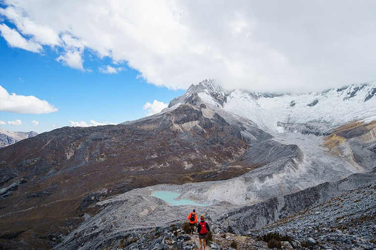
8 –REFUGIO CONTRAHIERBA (4100 M) – CAMP MIRADOR (4600 M)
Elevation gain: 850 m approx.
Elevation loss: 350 m approx.
Approximate hiking: 6 hours.
Difficulty: EE.
9 – CAMP MIRADOR (4600 M) – CAMP HUALLCACOCHA (4300 M)
Elevation gain: 600 m approx.
Elevation loss: 900 m approx.
Approximate hiking: 6.30-7 hours.
Difficulty: EE.
10 – CAMP HUALLCACOCHA (4300 M) – CAMP AUQUISCOCHA (4303 M)
Elevation gain: 800 m approx.
Elevation loss: 800 m approx.
Approximate hiking: 7 hours.
Difficulty: F+.
11 – CAMP AUQUISCOCHA (4303 M) – TIENDAYOC (3400 M)
Elevation loss: 900 m approx.
Approximate hiking: 3 hours.
Difficulty: EE.
Please contact DB600 for more information regarding this unique treck www.donboscoexpedition.com